Silberbergerweg
Path number: Nr. 40
Starting place: 4273 Kaltenberg
Destination: 4273 Kaltenberg
Kaltenberg 2
4273 Kaltenberg
4273 Kaltenberg

Hiking trail in Kaltenberg in the Mühlviertel region
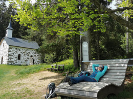
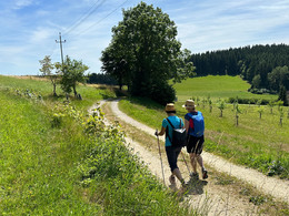
A secret resting place by the water, the valley of the Höllenbach stream, the Kammererkapelle chapel at 980 metres with magnificent views as far as the mountains: set off on the Silberbergerweg trail and discover the tranquillity and nature of the Mühlviertel region as well as the hospitality of the mountain inns.
Refreshments along the way
At the starting point in Kaltenberg, the traditional Kaltenbergerhof inn with its traditional cuisine invites you to stop for a bite to eat. In the cosy restaurant or in the guest garden, you will be well catered for.
Shortly after the start in Kaltenberg is the Langoth snack station, which will spoil you with a savoury snack, hearty meals and homemade pastries.
Halfway along the route, shortly after the Kammererkreuz cross, the farm shop and schnapps pavilion of the Thauerböck organic distillery awaits you. The schnapps pavilion invites you to linger and savour the organic distillates. The farm shop sells delicious organic products (whisky, Tschin, grain brandies, liqueurs, bacon, cabanossi, pitch oil) as well as specialities and snacks from Mühlviertel partner businesses (drinks, crispbread, sweets).
Naming
The Silberberg Trail leads from Kaltenberg via the village of Silberberg, which gives the trail its name. The name is presumably derived from "Katzensilber", the name given to the shiny chips in the granite rock. With a bit of luck, you might get chatting to the locals at the Silberberg village table.
Sights along the way
- St Mary's pilgrimage church in Kaltenberg
- Original chapel
- Augenbründl
- Place of reflection
- Chamber cross
- Ebenort Chapel
Trail variants
The Silberberger Weg can also be hiked in two different short variants, as there is a detour about halfway along the route (in the Ebenort area). The trail can therefore also be hiked in two shorter versions. However, if you don't want to miss out on anything, we recommend the long full loop.
Path number: Nr. 40
Starting place: 4273 Kaltenberg
Destination: 4273 Kaltenberg
duration: 4h 0m
length: 14,0 km
Altitude difference (uphill): 340m
Altitude difference (downhill): 340m
Lowest point: 746m
Highest point: 977m
difficulty: easy
condition: medium
panoramic view: Dreamtour
Paths covering:
Asphalt, Hiking trail
Starting point: Town centre opposite GH Kaltenbergerhof
Destination: Town centre opposite GH Kaltenbergerhof
further information:
- Flatly
- Possible accommodation
- Board possible
Spring to autumn
Accessibility / arrival
by car:
from Linz/Salzburg - A7 - B124 Königswiesener Straße - in Bad Zell turn left onto L576 Schönauer Straße to Unterweißenbach - turn left and follow the Nordkamm Landesstraße to Kaltenberg
- Suitable for groups
- Suitable for seniors
- Suitable for single travelers
- Suitable for families
- Suitable for friends
- Suitable for couples
- Suitable for children
- Spring
- Summer
- Autumn
Not suitable for wheelchairs. The property is not compliant with Austria's ÖNORM legal standard.
Kaltenberg 2
4273 Kaltenberg
Phone +43 7956 7305
E-Mail info@urkraftdorf.at
Web urkraftdorf.at/silberbergerweg/
https://urkraftdorf.at/silberbergerweg/


