

Baumgartenberg: Foothills of the Alps Views Loop Trail


- Flatly
Interactive elevation profile
Create PDF
Tour-Details
Starting place: 4342 Baumgartenberg
Destination: 4342 Baumgartenberg
duration: 3h 0m
length: 9,4 km
Altitude difference (uphill): 160m
Altitude difference (downhill): 160m
Lowest point: 233m
Highest point: 356m
difficulty: easy
condition: easy
panoramic view: Dreamtour
Paths covering:
Asphalt, Path / trail, Gravel, Other
powered by TOURDATA
Short description:
Steindl - Amesbach - Mühlberg - Baumgartenberg
Steindl - Amesbach - Mühlberg - Baumgartenberg
Quality of experience: ****
Recommended season:
- April
- May
- June
- July
- August
- September
- October
Properties:
Description:- Loop
We follow Donausteig Trail from the starting place in Baumgartenberg. We cross the forest after Amesberg and take a right turn before Sperken. We follow the course of the trail and take a left turn into the forest before the last farm. We keep to the right near Au and follow a side road towards Baumgartenberg that runs parallel to the main road. We cross the federal road and turn into a road in south-western direction. We follow the road to the starting point.Directions:
Vom Startplatz in Baumgartenberg ausgehend, folgen wir dem Donausteig. Nach Amesberg durchqueren wir den Wald und biegen vor Sperken rechts ab. Wir folgen dem Wegverlauf und zweigen vor dem letzten Bauernhof links in den Wald hinein ab. Bei Au halten wir uns rechts und gehen parallel zur Hauptstraße auf einer Nebenstraße Richtung Baumgartenberg zurück. Wir überqueren die Bundesstraße und biegen Richtung Südwesten auf eine Straße ein, der wir zum Ausgangspunkt folgen.Tip:
Diese Tour wird Ihnen präsentiert von der Tourismusregion Donau OberösterreichEquipment:
Wanderrucksack (inkl. Regenhülle), festes SchuhwerkAdditional information:
Baumgartenberg Municipal Office
4342 Baumgartenberg 85
Tel.: 0043(0)7269/255
Fax: 0043(0)7269/255-5
E-mail: gemeinde@baumgartenberg.ooe.gv.at
www.baumgartenberg.at
Starting point: Baumgartenberg
Destination: Sportplatz Baumgartenberg
further information:
- Flatly
Landgasthof Rechberger

Rastplatz Mühlberg

Rastplatz Weisses Kreuz
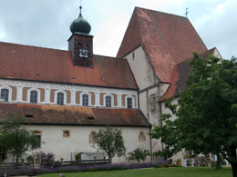
Starting Place Baumgartenberg

Startplatz Baumgartenberg
")
")
")
Resting Place Mühlberg
")
Accessibility / arrival
Public Transit
Train connection: Baumgartenberg train stationParking
Tennis court, municipal office, Kirchenplatz square
- Suitable for groups
- Suitable for single travelers
- Suitable for friends
- Suitable for couples
- Spring
- Summer
- Autumn
Please get in touch for more information.
Baumgartenberg 85
4342 Baumgartenberg
Phone +43 43 255
Fax machine +43 7269 255 - 5
E-Mail gemeinde@baumgartenberg.ooe.gv.at
Web www.baumgartenberg.at/
Web www.donauregion.at
https://www.baumgartenberg.at/
http://www.donauregion.at
http://www.donauregion.at
Interactive elevation profile
Create PDF
Tour-Details
Starting place: 4342 Baumgartenberg
Destination: 4342 Baumgartenberg
duration: 3h 0m
length: 9,4 km
Altitude difference (uphill): 160m
Altitude difference (downhill): 160m
Lowest point: 233m
Highest point: 356m
difficulty: easy
condition: easy
panoramic view: Dreamtour
Paths covering:
Asphalt, Path / trail, Gravel, Other
powered by TOURDATA