Racing bike hill world Mühlviertel - "Tour de Alm Road"
Path number: Nr. 9 | 182 km und 3976 hm
Starting place: 4274 Schönau im Mühlkreis
Destination: 4274 Schönau im Mühlkreis


Flatly
Possible accommodation
Lebensquellplatz 1
4283 Bad Zell
4283 Bad Zell

information: Road bike route - digitally prepared
Description: The navigation of the "Tour de Alm Road" road bike route is only available in digital form. You can easily download the GPS file from this page
In addition, the tour is also presented in our free A3 flyer .
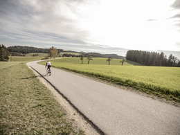
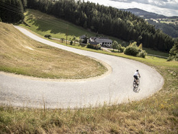
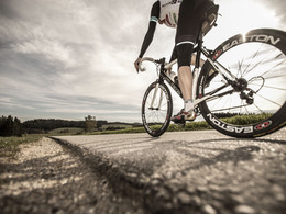
This challenging and long tour offers an incredible variety of the charming Mühlviertel. It leads along secluded roads through beautiful communities and climbs one hill after another. Lush alpine meadows and impressive granite formations can be found along the route and marvellous views as far as the Alpine foothills invite you to pause for a moment. Due to its length, the Tour de Alm Road can easily be planned as a two-day tour.
Path types:
Secondary road: 5.10 km
Road: 167 km
Main road: 8.19 km
Road condition:
Road surface: 110 km
Asphalt: 70.20 km
Parking facilities:
- Schönau im Mühlkreis at the Spar car park (the right-hand section is public)
Repair facilities:
- Kern Schuhe Sport in Königswiesen
- Weitblick guest house in St. Leonhard
- Kern Schuhe Sport in Unterweißenbach
Path number: Nr. 9 | 182 km und 3976 hm
Starting place: 4274 Schönau im Mühlkreis
Destination: 4274 Schönau im Mühlkreis
duration: 11h 15m
length: 182,3 km
Altitude difference (uphill): 3.740m
Altitude difference (downhill): 3.740m
Lowest point: 430m
Highest point: 1.040m
difficulty: very difficult
condition: very difficult
panoramic view: Great panorama
Paths covering:
Asphalt, Street
Starting point: Schönau im Mühlkreis at the Spar parking lot right part of the Spar parking lot is public
Destination: Schönau im Mühlkreis at the Spar parking lot right part of the Spar parking lot is public
further information:
- Flatly
- Possible accommodation
- Board possible
- Suitable for single travelers
- Suitable for friends
- Spring
- Summer
- Autumn
Please get in touch for more information.
")
Lebensquellplatz 1
4283 Bad Zell
Phone +43 5 07263 - 301
E-Mail badzell@muehlviertel.at
Web www.muehlviertel.at
https://www.muehlviertel.at
You can also visit us on
Facebook Instagram")
")


")
")
")
")
")

")
")
")
Altitude profile - Racing bike hill world Mühlviertel - "Tour de Alm Road"
powered by TOURDATA