

100 Rainbach round


Interactive elevation profile
Create PDF
Tour-Details
Path number: 100
Starting place: 4261 Rainbach im Mühlkreis
Destination: 4261 Rainbach im Mühlkreis
duration: 2h 29m
length: 32,6 km
Altitude difference (uphill): 450m
Altitude difference (downhill): 450m
Lowest point: 630m
Highest point: 753m
difficulty: medium
condition: easy
panoramic view: Great panorama
Paths covering:
Asphalt, Path / trail, Gravel, Street
powered by TOURDATA
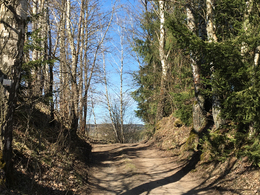
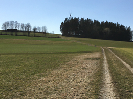
This tour starts at the market square in Rainbach. From here, the first five kilometres are mainly on slightly downhill terrain to Vierzehn. Once in Vierzehn, the first real climb awaits. After climbing this, you continue with a view of the Sternstein until you reach a short but steep descent on tarmac. An equally steep uphill section takes you to Summerau. After a few flat kilometres, the next slightly longer ascent to Zulissen follows. After another rapid descent, you reach the last long climb, which leads to Kerschbaum. Passing the horse-drawn railway museum, you cycle back to Rainbach over mainly flat terrain. The highlight of this tour is an approximately 200 metre long wooden bridge in the forest just before the end of the tour.


")
")
")
")
")
- Suitable for teenagers
- Suitable for single travelers
- Suitable for friends
- Suitable for couples
- Spring
- Summer
- Autumn
Please get in touch for more information.
")
Prager Straße 5
4261 Rainbach im Mühlkreis
Phone +43 7949 6255
E-Mail anfrage@muehlviertel.at
Web www.muehlviertel-urlaub.at/bike
https://www.muehlviertel-urlaub.at/bike
Interactive elevation profile
Create PDF
Tour-Details
Path number: 100
Starting place: 4261 Rainbach im Mühlkreis
Destination: 4261 Rainbach im Mühlkreis
duration: 2h 29m
length: 32,6 km
Altitude difference (uphill): 450m
Altitude difference (downhill): 450m
Lowest point: 630m
Highest point: 753m
difficulty: medium
condition: easy
panoramic view: Great panorama
Paths covering:
Asphalt, Path / trail, Gravel, Street
powered by TOURDATA