

Leitersteig - Haslersgatter - Muttling


- Flatly
Interactive elevation profile
Create PDF
Tour-Details
Path number: 9, 472, 8
Starting place: 4580 Windischgarsten
Destination: 4580 Windischgarsten
duration: 4h 18m
length: 10,4 km
Altitude difference (uphill): 704m
Altitude difference (downhill): 695m
Lowest point: 632m
Highest point: 1.288m
difficulty: medium
condition: medium
panoramic view: Great panorama
Paths covering:
Hiking trail
powered by TOURDATA
Partial lock: Forest road (Leitersteig - Haslergatter) closed
Description: The forest road is currently not passable. Winter closure!
Hike through the Salzatal valley to the Leitersteig, Haslersgatterl and Muttling and over the Wurbauerkogel back to Windischgarsten.
The trail heads uphill to the left around the Patzlkogel - climbing steeply up the slopes of the Hahnbaum to the Haslersgatter. Follow the Schafsteig trail past the Kleinerberg transmitter down to the goods road to Muttling.
From Muttling, continue to Kleinerbauer (AV 475) and Wurbauerkogel and from here via the Bannholzmauer on trail no. 8 back to the starting point.
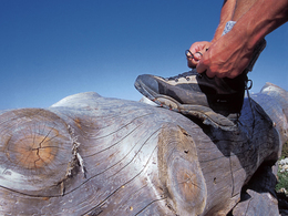
Mountain hike - surefootedness required, narrow trail in places
Hiking trail numbers: 9, 472 and 8
Starting point: Car park in front of the Moar im Hof, on the right before the "entrance" to the Salzatal, 4575 Roßleithen.
Destination: Car park in front of the Moar im Hof, on the right before the "entrance" to the Salzatal, 4575 Roßleithen.
further information:
- Flatly
- Board possible
Accessibility / arrival
by car:
West motorway A1 - exit Voralpenkreuz onto the A9 (Pyhrnautobahn) towards Graz - exit Roßleithen/Windischgarsten
over the railway tracks towards Windischgarsten town centre - turn left at the Purgleitner tannery (bottleneck) towards Villa Sonnwend. Continue straight on at the junction to Villa Sonnwend, car park on the right-hand side.
By train:
Linz main station - Windischgarsten
Graz - Selzthal - Windischgarsten
Take the hiking taxi to the starting point of the hike
- Suitable for kids (12 - 14 Year)
- Suitable for teenagers
- Suitable for seniors
- Suitable for single travelers
- Suitable for friends
- Suitable for couples
Surefootedness required!
Most economical season- Spring
- Summer
- Autumn
- Early winter
Please get in touch for more information.

Bahnhofstraße 2
4580 Windischgarsten
Phone +43 7562 5266
Fax machine +43 7562 5266 - 10
E-Mail info@pyhrn-priel.net
Web www.urlaubsregion-pyhrn-priel.at
https://www.urlaubsregion-pyhrn-priel.at

")
")
")


")
")
Interactive elevation profile
Create PDF
Tour-Details
Path number: 9, 472, 8
Starting place: 4580 Windischgarsten
Destination: 4580 Windischgarsten
duration: 4h 18m
length: 10,4 km
Altitude difference (uphill): 704m
Altitude difference (downhill): 695m
Lowest point: 632m
Highest point: 1.288m
difficulty: medium
condition: medium
panoramic view: Great panorama
Paths covering:
Hiking trail
powered by TOURDATA