Garstnereck Tour (R303)
Path number: R303
Starting place: 4580 Windischgarsten
Destination: 4580 Windischgarsten
Bahnhofstraße 2
4580 Windischgarsten
4580 Windischgarsten

Windischgarsten - Dörfl – golf course – swimming lake - Garstnereck – DANA company - Gleinkerau - Gleinkerseestrasse - Windischgarsten
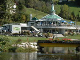
The Garstnereckrunde (R303) is a perfect variant for beginners and children and due to the shortness it can be done by everyone. This round can be optimally combined with the Enghagen round (R302). The beautiful Golf Salettl is open to all visitors and offers a great view of the 18-hole golf course at GC Dilly. In the summer months, the adjoining swimming lake is an absolute highlight.
Path number: R303
Starting place: 4580 Windischgarsten
Destination: 4580 Windischgarsten
duration: 0h 43m
length: 9,3 km
Altitude difference (uphill): 133m
Altitude difference (downhill): 137m
Lowest point: 592m
Highest point: 680m
difficulty: easy
condition: easy
panoramic view: Some Views
Paths covering:
Asphalt
Starting point: Windischgarsten tourist office
Destination: Windischgarsten tourist office
further information:
- Flatly
- Board possible
Accessibility / arrival
Tourist office Windischgarsten, Bahnhofstrasse 2.
Free parking at the gravel parking lot to the right of the Penny supermarket!
- Charging point for electric cars (fees apply)
- Suitable for groups
- Suitable for schools
- Suitable for kids (all ages)
- Suitable for teenagers
- Suitable for seniors
- Suitable for single travelers
- Suitable for families
- Suitable for friends
- Suitable for couples
- Suitable for children
- Spring
- Summer
- Autumn
Please get in touch for more information.
Bahnhofstraße 2
4580 Windischgarsten
Phone +43 7562 5266
Fax machine +43 7562 5266 - 10
E-Mail info@pyhrn-priel.net
Web www.urlaubsregion-pyhrn-priel.at
https://www.urlaubsregion-pyhrn-priel.at


