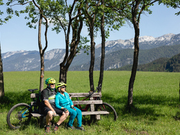
Aurunde Tour (R304)
Path number: R304
Starting place: 4580 Windischgarsten
Destination: 4580 Windischgarsten
Bahnhofstraße 2
4580 Windischgarsten
4580 Windischgarsten

Windischgarsten - Gleinkerseestrasse – turn-off Seebach - Ferienhof Schlagedl - Gleinkerau - Spital am Pyhrn - Pyhrnstrasse – golf course - Pistelmühle - Windischgarsten
A very flat circular tour through the Gleinkerau to Spital am Pyhrn and back to Windischgarsten. A classic training tour for the local biking scene.The Aurunde (R304) is a tour suitable for families and offers the opportunity to visit the natural jewel Gleinkersee with its high ropes course and Flying Fox Arena. From the Seebach junction, it is just under two kilometers uphill to Lake Gleinkersee. A detour that is well worth it!
The marked route continues to the abbey town of Spital am Pyhrn and then back to Windischgarsten. The way back from Spital am Pyhrn leads along the Pyhrnbahn to Windischgarsten.
Path number: R304
Starting place: 4580 Windischgarsten
Destination: 4580 Windischgarsten
duration: 1h 15m
length: 17,8 km
Altitude difference (uphill): 143m
Altitude difference (downhill): 145m
Lowest point: 586m
Highest point: 674m
difficulty: easy
condition: easy
panoramic view: Some Views
Paths covering:
Asphalt
Starting point: Windischgarsten tourist office, Bahnhofstrasse 2.
Destination: Windischgarsten tourist office, Bahnhofstrasse 2
further information:
- Flatly
- Board possible
Accessibility / arrival
Windischgarsten tourist office.
Free parking at the gravel parking lot to the right of the Penny supermarket!
- Charging point for electric cars (fees apply)
- Suitable for groups
- Suitable for schools
- Suitable for teenagers
- Suitable for seniors
- Suitable for single travelers
- Suitable for families
- Suitable for friends
- Suitable for couples
- Suitable for children
- Spring
- Summer
- Autumn
Please get in touch for more information.
Bahnhofstraße 2
4580 Windischgarsten
Phone +43 7562 5266
Fax machine +43 7562 5266 - 10
E-Mail info@pyhrn-priel.net
Web www.urlaubsregion-pyhrn-priel.at/
https://www.urlaubsregion-pyhrn-priel.at/


