105 St Oswald Round 1
Path number: 105
Starting place: 4271 St. Oswald bei Freistadt
Destination: 4271 St. Oswald bei Freistadt
Markt 80
4271 St. Oswald bei Freistadt
4271 St. Oswald bei Freistadt

From the starting point in St. Oswald, the longest ascent of this tour awaits right at the beginning.
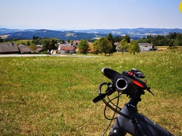
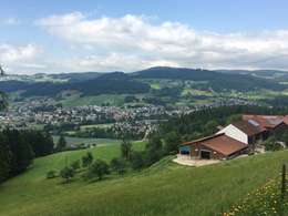
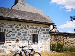
This winds its way for around four kilometers to the summit of the Braunberg. After a very short descent, you ride from Stiftungsberg to Amesreith on easy paths. From here, the route leads along a "plateau" through some very dense forests, which are interrupted by large meadows, to Mitterbach. Before you reach the approximately five-kilometre descent back to St. Oswald, you pass the beautiful "St. Michael" church in Oberrauchenödt.Around 38% of the route is on natural trails, while the remaining 62% is on paved paths and asphalt (11%).
Nature is always there for us. So it is only fair that we are there for nature too.
Please observe the fair play rules for mountain biking!
Path number: 105
Starting place: 4271 St. Oswald bei Freistadt
Destination: 4271 St. Oswald bei Freistadt
duration: 2h 49m
length: 33,0 km
Altitude difference (uphill): 768m
Altitude difference (downhill): 766m
Lowest point: 603m
Highest point: 961m
difficulty: medium
condition: medium
panoramic view: Great panorama
Paths covering:
Asphalt, Path / trail, Gravel, Street
Starting point: Public parking lot at the Funiversum opposite the municipal office
Destination: Public parking lot at the Funiversum opposite the municipal office
- Suitable for groups
- Suitable for teenagers
- Suitable for single travelers
- Suitable for friends
- Suitable for couples
- Spring
- Summer
- Autumn
Please get in touch for more information.
Markt 80
4271 St. Oswald bei Freistadt
Phone +43 7945 7255
E-Mail anfrage@muehlviertel.at
Web www.muehlviertel-urlaub.at/bike
Web www.stoswald.at/Unser_Ort/Freizeit_…
https://www.muehlviertel-urlaub.at/bike
https://www.stoswald.at/Unser_Ort/Freizeit_Tourismus/Sportanlagen
https://www.stoswald.at/Unser_Ort/Freizeit_Tourismus/Sportanlagen


