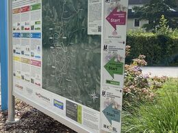
TECHNOSERT Round - COUNT IT Bewegungsarena Hagenberg
Path number: H9
Starting place: 4232 Hagenberg im Mühlkreis
Destination: 4232 Hagenberg im Mühlkreis
Kirchenplatz 5a
4232 Hagenberg im Mühlkreis
4232 Hagenberg im Mühlkreis

H9 Technosert tour: Varied tour to the municipal borders.
A varied route to the municipal boundaries: Past the castle chapel in the direction of Stöcklgraben, through a wooded area into Kapellenstraße and to the 3-community corner at Pregarten railway station. The Hacklberg is the steepest section of the route. You are rewarded with a wonderful view over the three communities. You reach the village of Anitzberg through the Visnitz Valley and return to the starting point on the old church path.Start: Schlosspark
Path number: H9
Starting place: 4232 Hagenberg im Mühlkreis
Destination: 4232 Hagenberg im Mühlkreis
duration: 1h 42m
length: 10,0 km
Altitude difference (uphill): 228m
Altitude difference (downhill): 232m
Lowest point: 363m
Highest point: 482m
difficulty: difficult
condition: difficult
panoramic view: Great panorama
Paths covering:
Asphalt, Gravel, Hiking trail
Starting point: Hagenberg Castle Park
Destination: Hagenberg Castle Park
further information:
- Flatly
- Possible accommodation
- Experience of nature
Accessibility / arrival
Coming from Linz:
Follow the A7 motorway in the direction of Freistadt until the Unterweitersdorf exit. Follow the Königswiesener Str./B124 to Hagenberg.
- Free entry
- All weather
- Suitable for groups
- Suitable for single travelers
- Suitable for families
- Suitable for friends
- Suitable for couples
- Spring
- Summer
- Autumn
- Early winter
Please get in touch for more information.
Kirchenplatz 5a
4232 Hagenberg im Mühlkreis
Phone +43 7236 2318
E-Mail gemeinde@hagenberg.ooe.gv.at
Web www.hagenberg.at/bewegungsarena
https://www.hagenberg.at/bewegungsarena


